As climate change continues to be an increasingly pressing issue, the Canadian Space Agency is making an unprecedented number of RADARSAT-1 synthetic aperture radar (SAR) images of Earth freely available to researchers, industry and the public. The 674,000 historical images are a significant increase to the 36,000 images already publicly available through the Government of Canada’s Earth Observation Data Management System.
The image release initiative is part of Canada’s Open Government efforts to encourage novel Big Data Analytic and machine learning activities by users. It also aligns with Canada’s Space Strategy, which prioritizes acquiring and using space-based data to support science excellence, innovation and economic growth.
The global satellite Earth observation market is estimated at US$3.3 billion and expected to grow to US$7.2 billion over the next decade. A strategy aims to help Canadian space firms capture an increased share of this global market. The Government of Canada’s investment of $90 million in Budget 2021 to capitalize on satellite Earth observation, as well as the recent $20 million in funding to Canadian company GHGSat for the enhanced measurement of methane, are meant to help ensure Canada has the information needed to tackle climate change and safeguard critical services into the future.
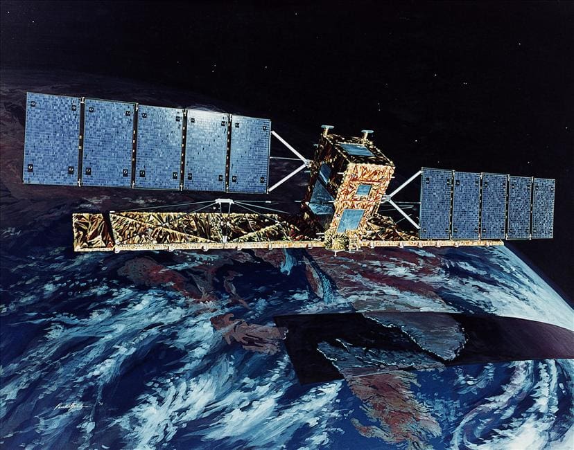
Generating the world’s longest timespan of SAR data as Canada’s first Earth observation satellite, RADARSAT-1 has already provided essential information to government, scientists and commercial users. But there is still more to uncover. The release of images is in collaboration with the Alaska Satellite Facility, MDA, NASA, and Natural Resources Canada.
Comparisons of these unique images from RADARSAT-1’s 17 years of operation are invaluable for climate change research through features such as sea ice cover, seasonal changes and climate change effects, particularly in Canada’s North. Beyond climate change, the data is also applicable to geology, coastal monitoring, agriculture, disaster management, monitoring land use changes over time and more. Historical images of volcanos and earthquakes can show land deformation over time. Ocean water imagery can reveal historical events such as glacier calving and storms. In agriculture, images have helped with identifying crops, assessing moisture content, and predicting crop yields. They have also played a key role in responding to floods, oil spills, earthquakes, landslides and volcanic activity.
Satellites help monitor, understand and protect our planet.
Satellites provide a unique perspective of our planet. They support cutting-edge science, and enable applications and services in many areas critical to the health and well-being of Canadians. For more than 50 years, Canadian experts have been using satellites to monitor our environment from space. As the effects of climate change in Canada are increasingly clear, satellites can gather essential information more effectively than ever before to help us better understand and protect our planet.
Accordingly, the Canadian Space Agency (CSA) is investing $8 million in 21 organizations across Canada to advance innovative applications through the use of satellite data. An event was held to announce this funding, delivered through the smartEarth initiative, and to highlight the newly released Resourceful, Resilient, Ready: Canada’s Strategy for Satellite Earth Observation.
The CSA is funding the smartEarth initiative to promote the development of applications through the use of satellite data to help meet various needs on Earth, while growing Canada’s space sector expertise and growth.
“Satellites offer valuable information that can change our lives for the better here on Earth. This strategy is designed to provide useful and precise information on our planet to inform the Government’s decisions and empower Canadian businesses – big and small – to innovate and take on the real, tangible challenges we face in our day-to-day lives like climate change, forest fires and floods.”
François-Philippe Champagne, Minister of Innovation, Science and Industry
With the smartEarth initiative, the CSA promotes the development of innovative applications to help meet various needs on Earth, while enhancing the expertise and growth of Canada’s space sector. The global satellite Earth observation market is estimated at US$3.3 billion and is expected to grow to US$7.2 billion over the next decade.
Satellite data can help advance cutting-edge science, guide emergency responses, and support industries to better understand and protect our planet
- The Canadian Space Agency, Environment and Climate Change Canada, and Natural Resources Canada led a whole-of-government effort to seek input from industry and academia to develop this long-term satellite Earth observation strategy.
- The global satellite Earth observation market is estimated at US$3.3 billion and expected to grow to US$7.2 billion over the next decade. The new strategy aims to help Canadian space firms capture an increased share of this global market.
- The CSA funding initiative smartEarth promotes the development of innovative applications through the use of satellite data to help meet various needs on Earth, while enhancing Canada’s space sector expertise and growth.
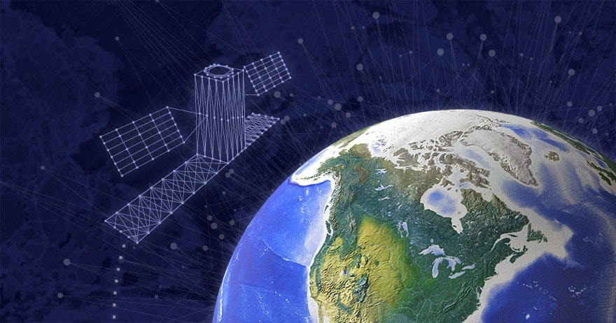
- The unique data, provided by satellites like the Canadian RADARSAT Constellation Mission, supports science, public health, security, emergency response and many industries, such as agriculture and natural resource management. Data acquired by Canadian satellites and instruments (e.g. SCISAT, MOPITT [on Terra], OSIRIS [on Odin], RADARSAT-2 and the RADARSAT Constellation Mission) provides critical information that helps advance our understanding of the climate system.